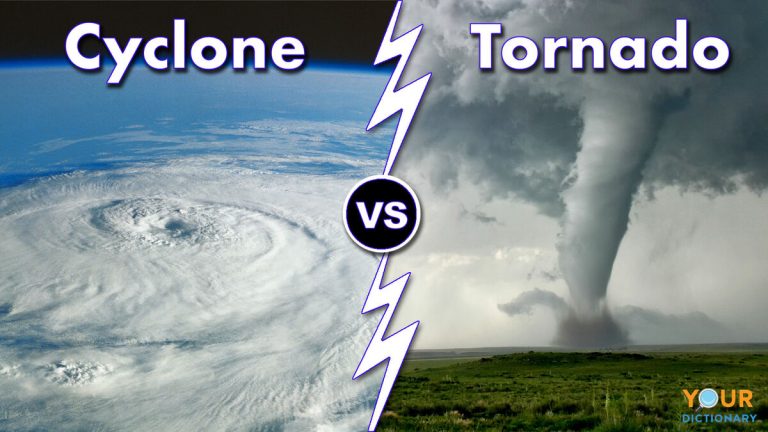
What Do Tornado Clouds Look Like
Tornadoes are one of nature’s most powerful and destructive forces. These swirling vortexes of wind can cause massive damage in a matter of minutes, leaving behind a path of destruction. But what exactly do tornado clouds look like? In this article, we will explore the characteristics of tornado clouds and how they form, giving you a better understanding of these ominous weather phenomena.
**Tornado Clouds: A Closer Look**
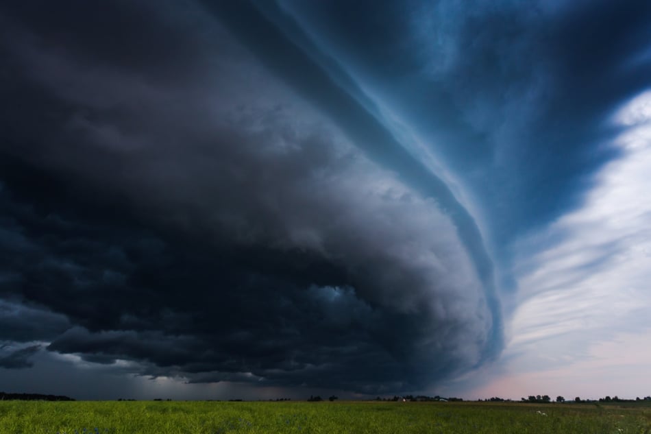
Tornado clouds, also known as supercell thunderstorms, are the breeding grounds for tornadoes. These massive storm systems are characterized by their rotating updrafts and mesocyclones, which are large-scale cyclonic circulations within the storm. The combination of intense inflow and powerful updrafts creates the perfect conditions for tornado formation.
**The Anatomy of a Tornado Cloud**
To understand what tornado clouds look like, we need to examine their structure. Tornado clouds typically have a unique appearance, with distinct features that set them apart from regular thunderstorms. Let’s delve into the different components of a tornado cloud:
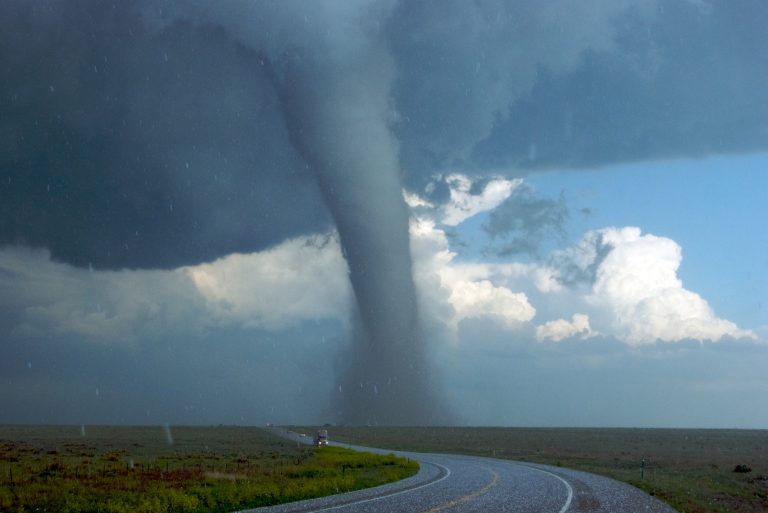
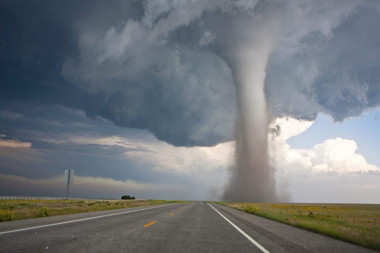
1. **Wall Cloud**: One of the most prominent features of a tornado cloud is the wall cloud. This is a large, lowering cloud formation that extends beneath the base of the storm. It appears dark and ominous, often displaying a rotating motion. The wall cloud is where tornadoes form, as the rotating updraft brings in warm, moist air from the ground.
2. **Funnel Cloud**: As the wall cloud continues to rotate and intensify, a funnel cloud may descend from the base. This is a tapered, swirling column of cloud that extends downward from the storm. Funnel clouds are not yet in contact with the ground, but they are a clear indication that a tornado is imminent.
3. **Tornado**: When a funnel cloud makes contact with the ground, it becomes a tornado. Tornadoes can vary in size and intensity, ranging from small and weak to large and destructive. The rotating winds within the tornado can reach speeds exceeding 300 miles per hour, causing widespread damage.
**Distinguishing Features of Tornado Clouds**
Now that we understand the basic structure of tornado clouds, let’s dive into the specific characteristics that set them apart:
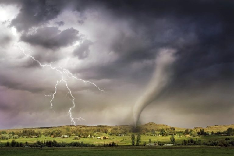
1. **Rotation**: Tornado clouds have a distinct rotating motion, visible in the wall cloud, funnel cloud, and tornado itself. This rotation is caused by the powerful updrafts and wind shear within the storm. The rotation is often counterclockwise in the Northern Hemisphere and clockwise in the Southern Hemisphere.
2. **Dark Coloration**: Tornado clouds tend to have a dark, menacing appearance. This is due to the high concentration of moisture and debris within the storm. The interaction of sunlight with these elements creates shadows and an overall somber atmosphere.
3. **Low Cloud Base**: Unlike regular thunderstorms, tornado clouds have a low cloud base. This means that the bottom of the storm is closer to the ground, often hovering just a few hundred feet above the surface. The low cloud base contributes to the intense storm activity and the potential for tornado formation.
4. **Rapid Changes**: Tornado clouds can change rapidly, both in appearance and intensity. The rotation may intensify or weaken, and the funnel cloud may descend or dissipate. This dynamic nature makes tornadoes particularly unpredictable and dangerous.
**Understanding Tornado Cloud Formation**
Tornado clouds form under specific atmospheric conditions that are conducive to severe weather. Here’s a brief overview of the process:
1. **Unstable Air**: Tornadoes often develop in an environment with warm, moist air near the surface and colder air aloft. This creates a condition known as instability, where the warm air rises rapidly, initiating the formation of thunderstorms.
2. **Wind Shear**: Wind shear refers to the change in wind speed and direction with height. In the presence of wind shear, the updrafts within a storm can start to rotate, forming a mesocyclone. This rotating updraft is the precursor to tornado formation.
3. **Trigger Mechanism**: A trigger mechanism, such as a frontal boundary or an outflow boundary from a different storm, is often necessary to initiate tornado development. These boundaries can disrupt the equilibrium in the atmosphere and provide the necessary lift for the storm to intensify.
**Frequently Asked Questions**
Frequently Asked Questions
Q: Can tornado clouds form without a wall cloud?
Yes, tornadoes can form without a visible wall cloud. In some cases, the wall cloud may be obscured by rain or other low-level clouds. However, the absence of a visible wall cloud does not necessarily mean that a tornado is not present.
Q: Are tornado clouds always black or dark in color?
While tornado clouds often appear dark, they can take on various colors depending on the ambient lighting conditions. The presence of significant debris within the storm can create a grayish or brownish hue. Additionally, the interaction of sunlight with the cloud can cause a range of colors, including greenish or bluish tints.
Q: How long do tornado clouds typically last?
The lifespan of a tornado cloud can vary widely. Some tornado clouds may only last a few minutes, while others can persist for several hours. The duration depends on factors such as atmospheric conditions, storm dynamics, and the strength of the tornado itself.
Q: Is it possible to predict the formation of tornado clouds?
While meteorologists have made significant advancements in tornado forecasting, accurately predicting the formation of tornado clouds remains a challenge. Tornadoes can develop rapidly and often without much warning. However, advances in weather radar technology and the use of computer models have improved our understanding and ability to issue timely tornado warnings.
Final Thoughts
In conclusion, tornado clouds are a fascinating yet dangerous weather phenomenon. Their distinct features, including rotating updrafts, wall clouds, funnel clouds, and tornadoes, make them easily identifiable. Understanding how tornado clouds form and recognizing their characteristics can help us better prepare for these destructive storms. By staying informed and taking appropriate precautions, we can mitigate the risks associated with tornadoes and protect ourselves and our communities.